1 May 2024
Milwaukee’s Ghost Signs Revealed in a New ‘Augmented History’ Tour
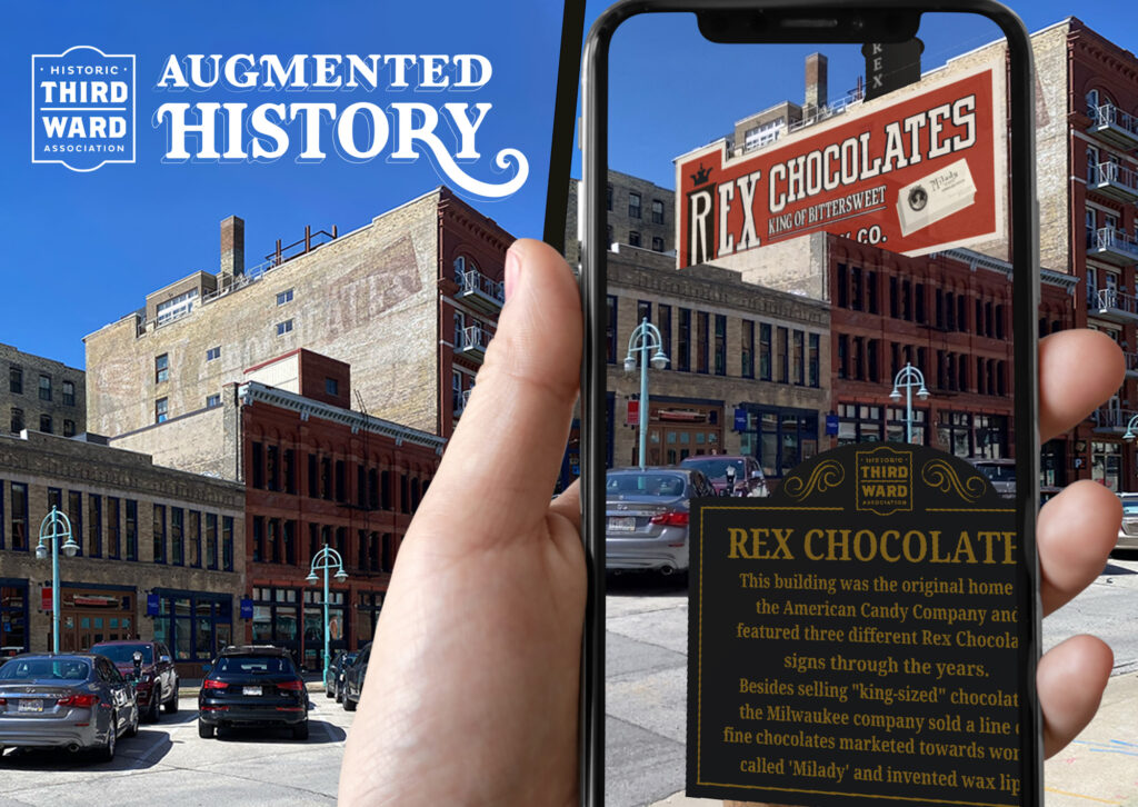
In Milwaukee, Wisconsin, a local advertising agency has collaborated with the Historic Third Ward Association to deliver a ghost signs walking tour via the technology of augmented reality. The project, dubbed ‘augmented history’, is the work of Hoffman & York, and I spoke with their Executive Creative Director, and project leader, Mike Roe, to learn more.
The Third Ward
The project is centred in Milwaukee’s Historic Third Ward district which, in 1892, suffered a huge loss of property following a fire. The reconstruction in the decades that followed have given this part of the city a particular architectural character which is now recognised on the National Register of Historic Places. This grants its buildings a high level of protection from overzealous urban (re)development.
However, in 1970s the area had fallen into decline and it wasn’t until the next decade that its fortunes were to shift.. This is when local businesses and the City of Milwakee formed the Historic Third Ward Association as a conduit for investment in the area, and its heritage. Now, 40 years later, the Historic Third Ward is a bustling commercial and entertainment district.
The Ghost Signs
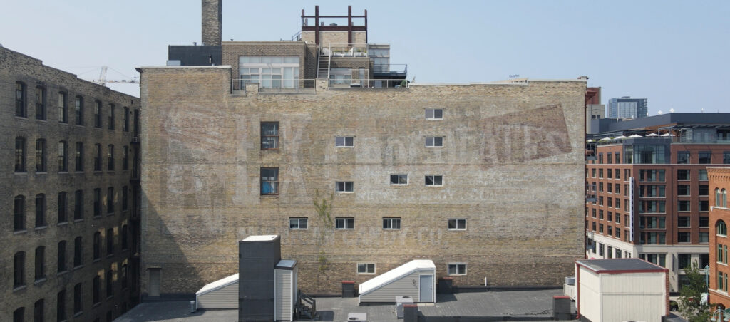
This Historic Third Ward is only about ten blocks by ten, but within this relatively small area there are between 35–45 ghost signs of varying degrees of fadedness. These, like their host buildings, are protected, and span myriad businesses that used to trade or advertise in the area. They are just a handful of survivors from the plentiful painted wall signs that have come and gone in this part of Milwaukee.
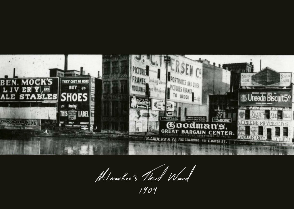
It wasn’t long after starting work at Hoffman & York that Executive Creative Director Mike Roe became aware of this high density of fading painted signs and felt the urge to do something creative with/about them.
Augmented History
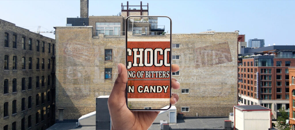
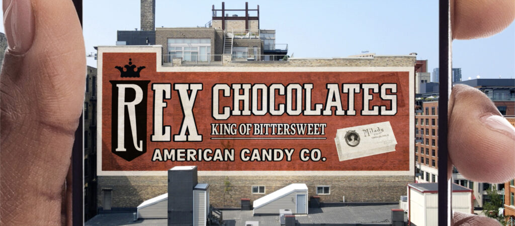
Mike soon hit on the idea of using augmented reality to digitally project recreated ghost signs onto the walls that host them. (This, in essence, uses mobile technology to virtually do what Craig Winslow’s Light Capsules facilitate with light projections.)
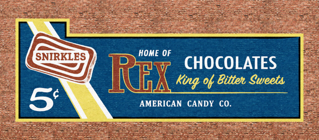
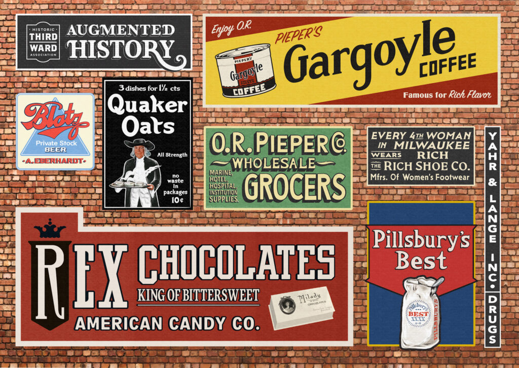
To realise the idea, Mike brought together an interdisciplinary team within the agency, and also became a regular at the local archives to research individual signs and locations. In some cases this threw up archival images, which then fed into the process of recreating the signs’ artwork. Additional references like old packaging and advertising also helped in isolating typographic and other graphic elements.
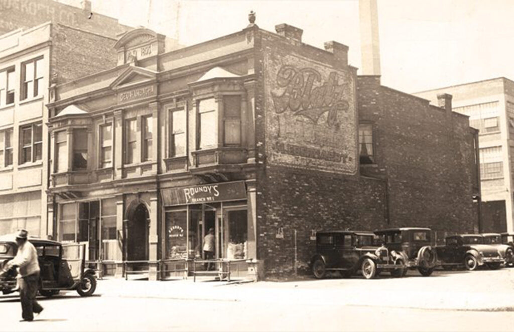
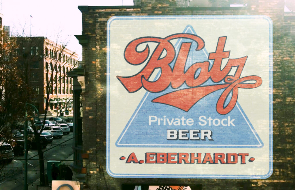
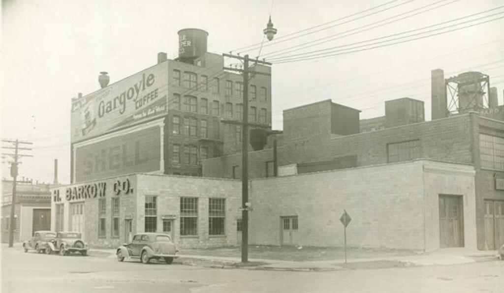
In many cases there were dead ends, or old photos that weren’t from quite the right angle, or where the sign was too far in the background to be traced with sufficient accuracy. However, 14 individual signs made it to the final selection.
One of the key technical challenges was making the augmented reality function at street level. The technology works by ‘anchoring’ points in the environment and using these to map images, text, or video onto specific surfaces. (There are parallels with the three blocks in the corners of most QR codes which allow your mobile device to identify and focus on the code itself.)
Anchoring is difficult in urban environments where myriad angles need to be accounted for, and where the anchoring points can be obscured by other buildings, or confused by temporary or permanent changes in the streetscape. The developers working on the project resolved this through the use of GPS; this provided an additional data point, allowing for triangulation and greater accuracy when identifying the walls and mapping the graphics onto them.
Partnership & Delivery
With an early prototype in place, Mike and his team presented the concept to the Historic Third Ward Association. They immediately saw the ways it could support their role in championing local heritage, and encouraging footfall local businesses. A partnership was born, and the association and advertising agency worked together to complete the project’s development and deployment via a dedicated website at augmentedhistory.org.
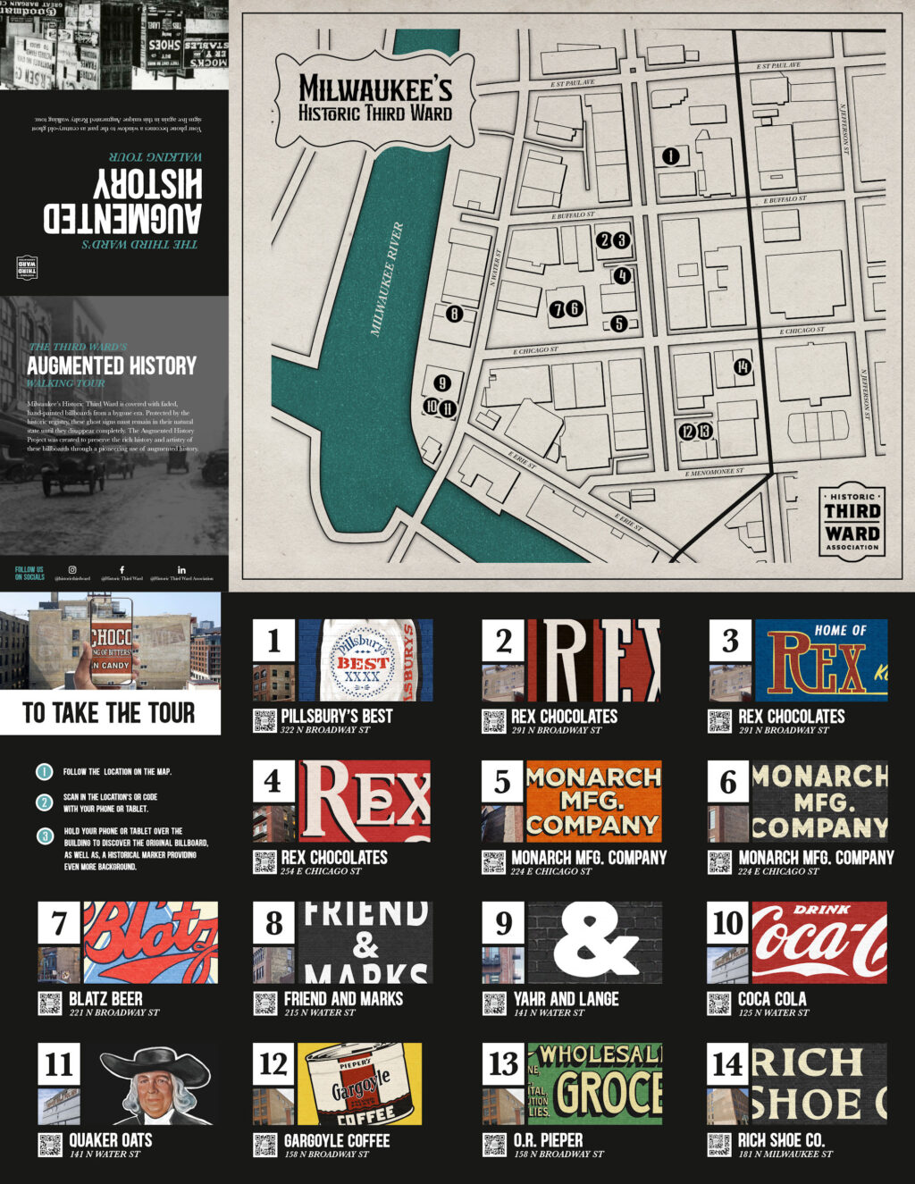
The web application features 14 ghost signs, allowing you to point your phone/mobile device at the walls and see the team’s recreations of their original artwork. There are also accompanying historical notes for each location, and a map that pinpoints each ghost sign.
For now, the application can only be accessed at street level in Milwaukee. However, I have suggested it would be nice to have a version accessible outside of the city for those unable to travel, or who can’t get out onto the street—something I have integrated into my digital walking tours. In the meantime, another way to learn about the city’s ghost signs is via the book, Fading Ads of Milwaukee by Adam Levin.
Thank you to Mike Roe for sharing the details of this project, and to Danella Uzelac for the various photos and supporting visual materials. The Augmented History site can be found at augmentedhistory.org.
