28 Jun 2007
Google Earth Experiment
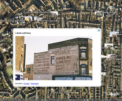
Last winter I took some of my photos from Flickr and attempted to begin building a map of signs and locations. You can see my preliminary results here if you have Google Earth installed on your machine.
You can zoom in and move around and then click on the thumbnail signs for a bigger view (it can take a little while for Google Earth to link to Flickr). You can see quite a lot of activity in North London, home for me, but also how this could build into a national or global survey of signs. If you or anyone you know is proficient in Google Earth and how to make this possible I’d love to hear from you.


